Description
Plan of A&D McLeod Land
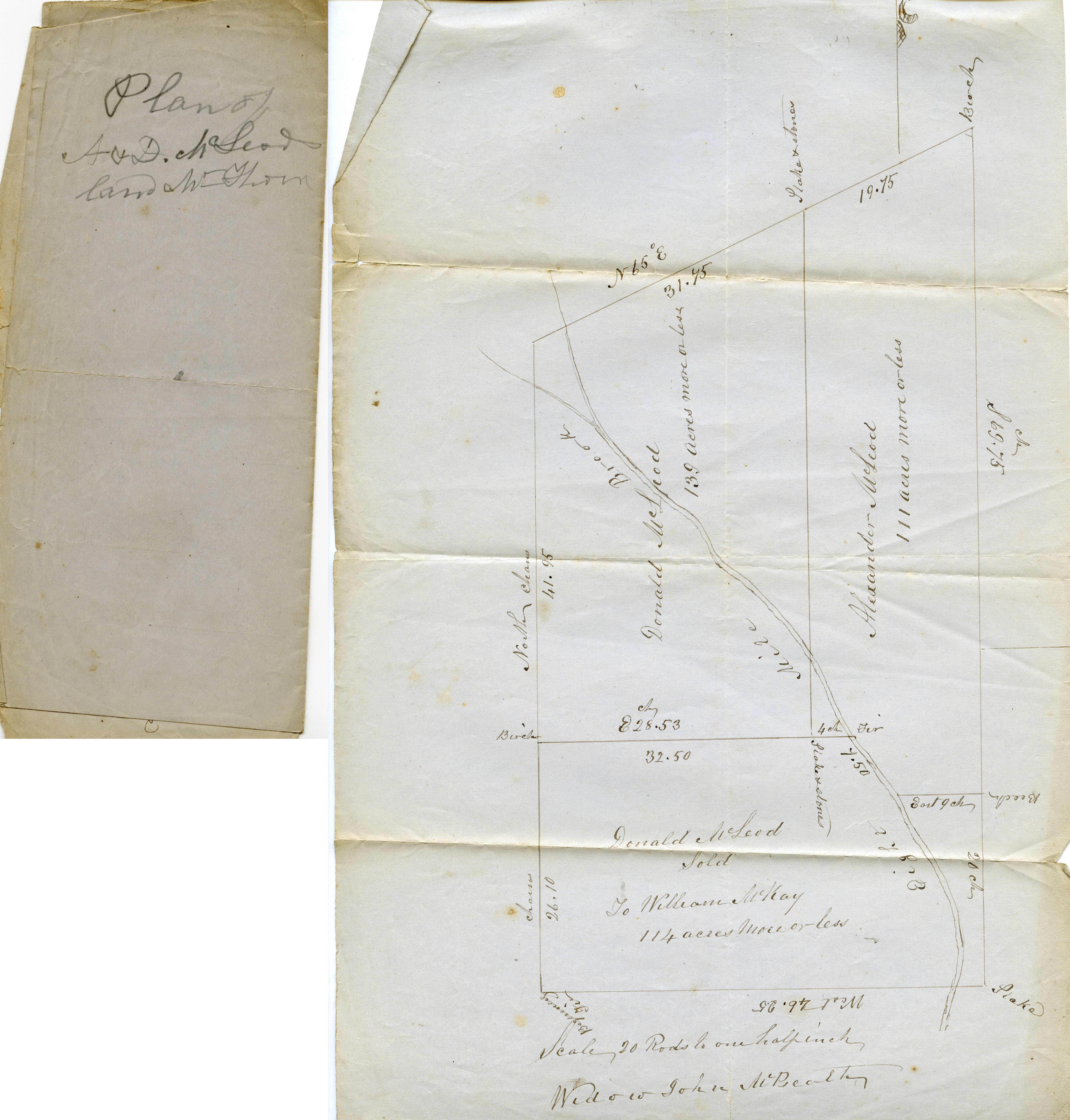
Front:
“Plan of
A&D McLeod
land Mt Thom”
Inside:
“Scale, 20 Rods to on half inch
Widow John McBeath”
Survey map includes properties of Donald McLeod, sold to William McKay, Donald McLeod, and Alexander McLeod, as well as the Eight Mile Brook.
Alternate Details
Part of the MacLeod Papers Collection containing the files of Ebenezer McLeod of West River, a Hector descendant and surveyor, and his son Daniel. The papers, which are from the 19th and 20th centuries, were saved by Ebenezer’s great-great-grandson Medford MacLeod, also of West River, NS.
File Location
MacLeod Papers Folder, Digital
Details
| File number: | MacLeod Papers 13 |
| Contributor: |
 Susan
Parker
|
View all submissions
Susan
Parker
|
View all submissions
|
| Tags: | MacLeod Papers, McLeod, MacLeod, Alexander McLeod, survey, survey map, map, Mt. Thom, John McBeath, Donald McLeod, William McKay, Eight Mile Brook |
| Views: | 1000 |
| Uploaded on: | May 26, 2017 |
| Source: | MacLeod Papers Collection |
Know something about this image?