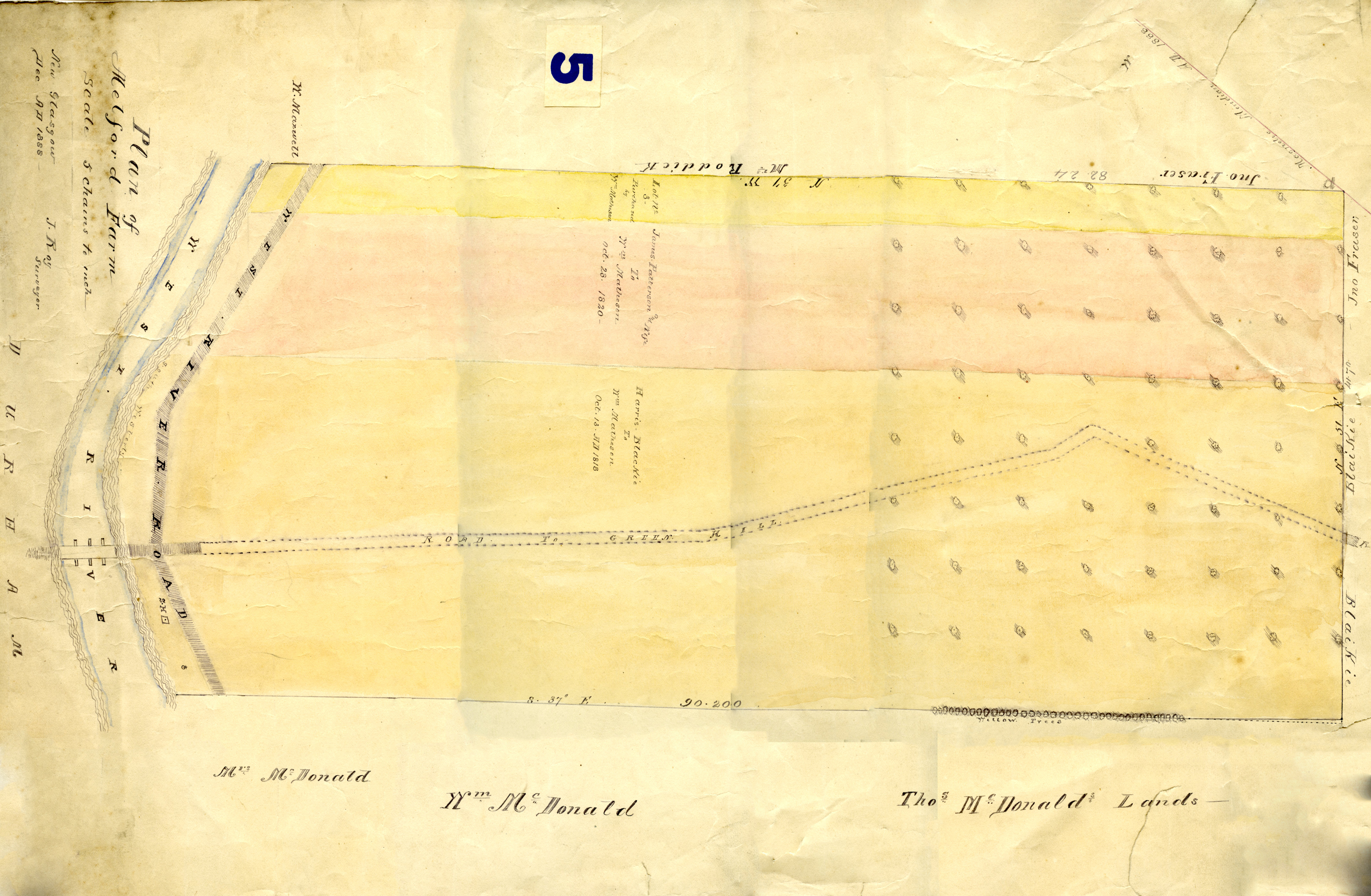
Survey of land of Melford Farm on the east side of the West River in Durham. Made by J. Roy of New Glasgow, December 1888.
Map features the West River Road (east side) along the West River by the Durham bridge, along with the former road to Greenhill in the centre. William Matheson bought three plots of land (one from James Patterson and wife on Oct. 28, 1830, and one from Harris-Blackie on Oct. 13, 1818), which form to make the Melford farm lot. The lot borders thoses of Mrs. McDonald, William McDonald, and Thomas McDonald on the south; William Maxwell, Mrs. Roddick, and John Fraser on the north; John Fraser and Blaikie on the east; and the land of the school house and Durham Cemetery on the west.
Melford farm is now run as the Parker farm (strawberries, pumpkins) in Durham.
Vault - Top of Photo Cabinet
| File number: | 2015-08-05 |
| Contributor: |
|
| Tags: | map, Durham, McDonald, Thomas McDonald, William McDonald, John Fraser, Blaikie, William Matheson, Harris Blackie, James Patterson, William Maxwell, Durham school house, Durham cemetery, Mrs. Roddick, Melford Farm |
| Views: | 1038 |
| Uploaded on: | July 21, 2015 |